![WMU 352 Berland - 36"W x 24"H (2 Map Set)](http://www.cartographix.ca/cdn/shop/products/WMU_352_1024x1024.png?v=1602605134)
![WMU 352 Berland - 36"W x 24"H (2 Map Set)](http://www.cartographix.ca/cdn/shop/products/1_1024x1024.png?v=1602605134)
![WMU 352 Berland - 36"W x 24"H (2 Map Set)](http://www.cartographix.ca/cdn/shop/products/2_1024x1024.png?v=1602605134)
![WMU 352 Berland - 36"W x 24"H (2 Map Set)](http://www.cartographix.ca/cdn/shop/products/3_1024x1024.png?v=1602605134)
![WMU 352 Berland - 36"W x 24"H (2 Map Set)](http://www.cartographix.ca/cdn/shop/products/4_1024x1024.png?v=1602605134)
![WMU 352 Berland - 36"W x 24"H (2 Map Set)](http://www.cartographix.ca/cdn/shop/products/5_1024x1024.png?v=1602605134)
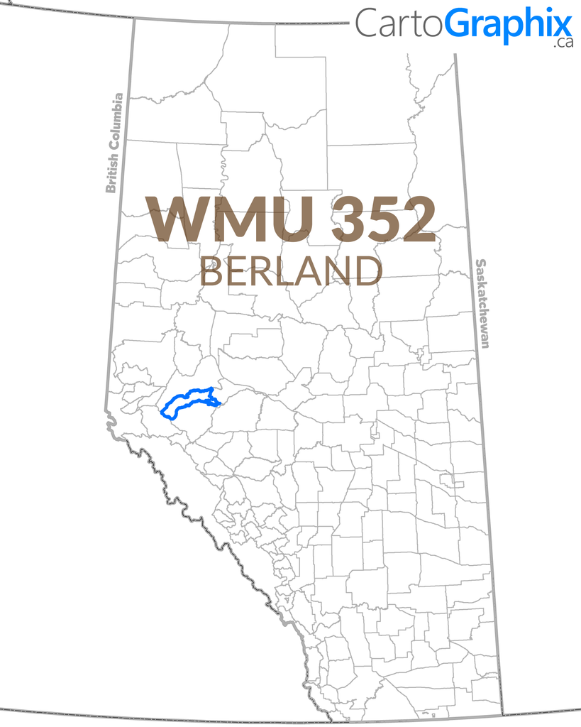
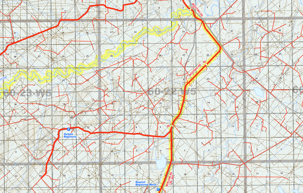
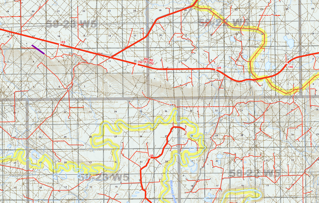
This product consists of two maps (East and West halves of WMU 352)Map Size:Width: 36" Height: 24" Scale: 1:100,000 (East), 1:125,000 (West)
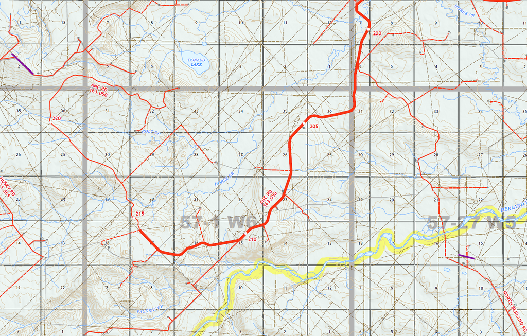
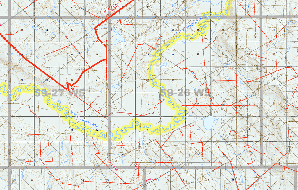
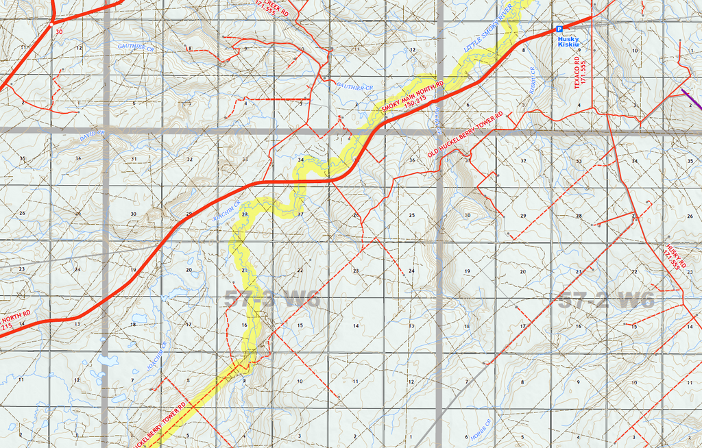
Map Features:
- PatchMap™ detailed oilfield roads, with named county roads
- Seismic lines, trails, pipeline/infrastructure corridors
- Private/Crown Land
- Labeled Gas and Waste Plants
- Major oilfield facilities and wellsites
- Labeled Township and Section Grid
- Detailed named streams and waterbodies
- Parks and Protected Areas
- First Nations Reserves, Metis Settlements
- Relief shade background
WMU maps can be printed on high quality, tear-proof paper, or heavyweight paper. |
All our maps can be customized - contact us for more information.