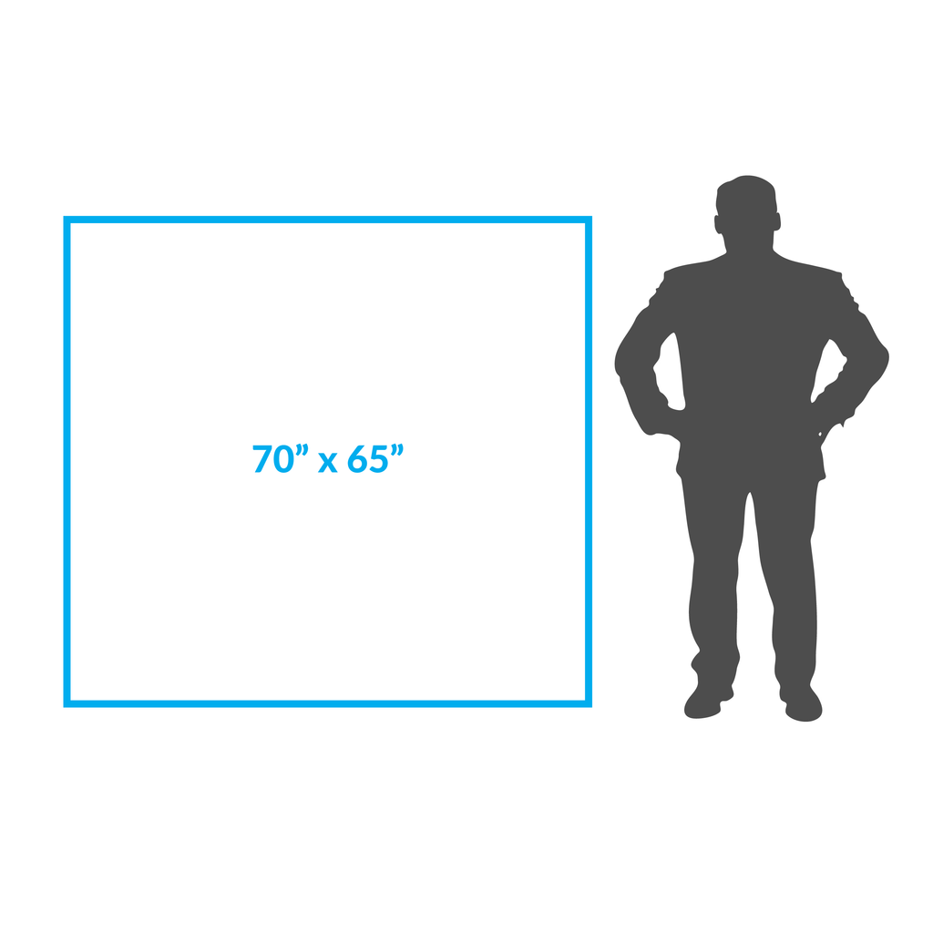
Map Size:Width: 70"Height: 80"
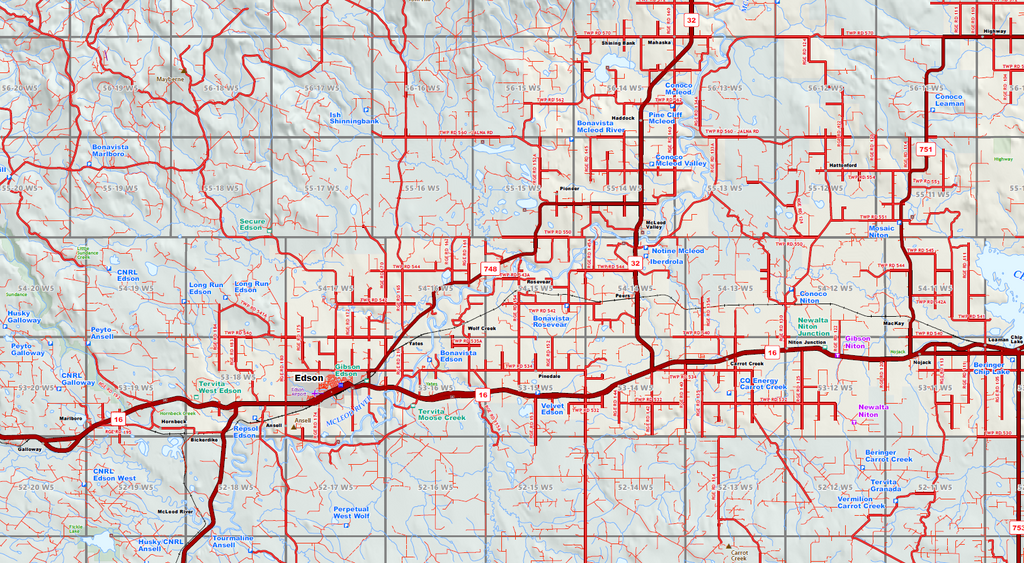
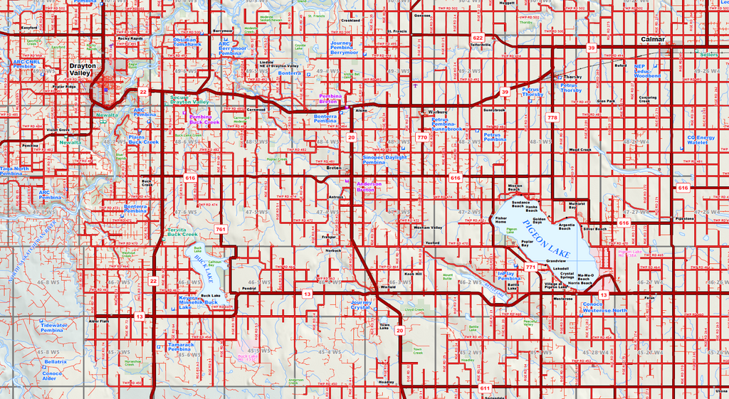
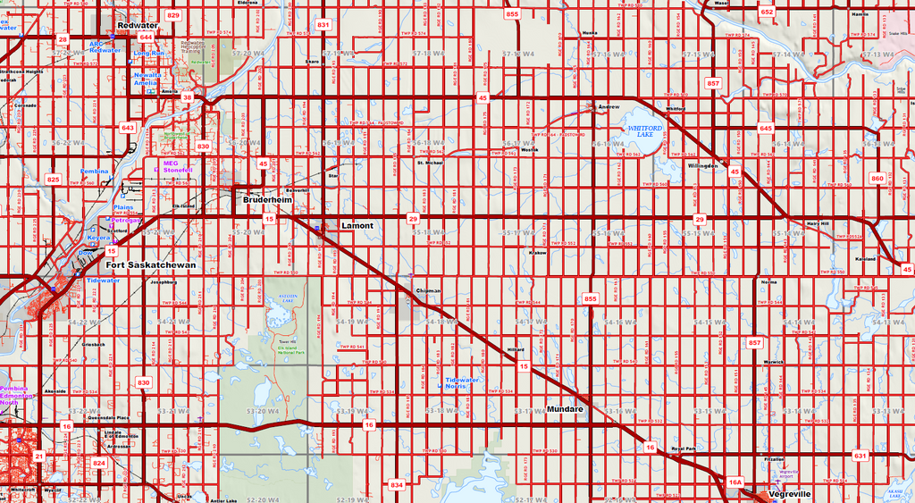
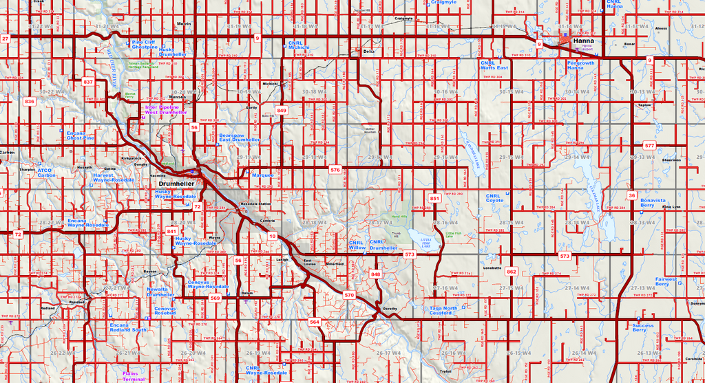
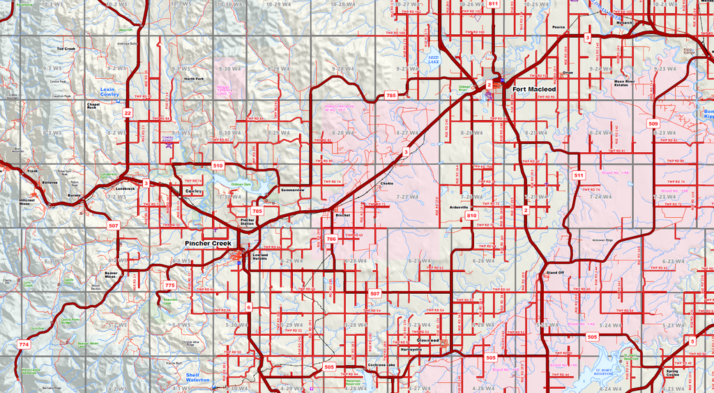
Map Features:PatchMap™ detailed oilfield roads, with fully named county roadsLabeled gas plants, waste plants, injection plants and truck terminalsLabeled Township and Section GridDetailed streams and waterbodiesParks and Protected AreasFirst Nations Reserves, Metis SettlementsRelief Shade background
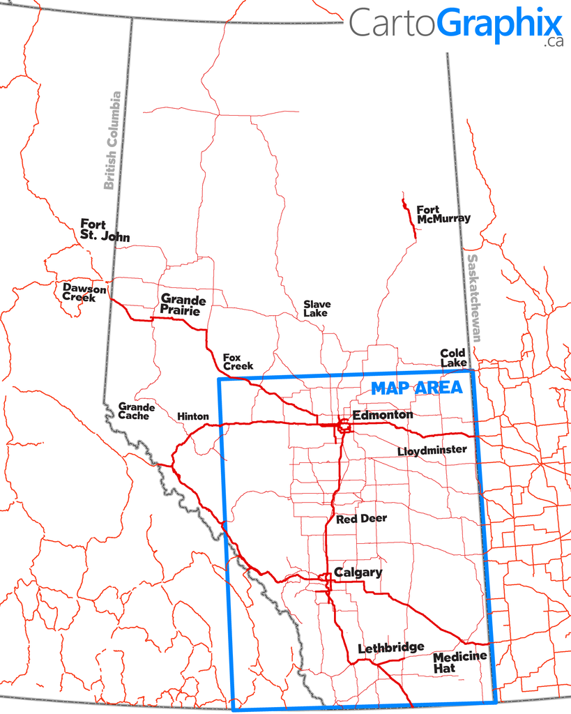
Map Extents:Left: Edson, AB (Rge 21 W5 )Right: Alberta / Sask. Border (Rge 1 W4)Bottom: CAN/US Border (Twp 1)Top: Mayerthorp (Twp 57)
| Printed on Super-High-quality, tear-proof polypropylene 'paper'. |
Like any of our maps, this map can be customized. Contact us for more info..